A coordinated surge of seismic and volcanic activity has struck the Pacific Rim and North Atlantic regions within a 24-hour period, highlighting the interconnected nature of global geological systems as Iceland experiences its most significant earthquake swarm in six months while Pacific nations grapple with volcanic eruptions and tsunami alerts.
Iceland's Reykjanes Ridge Awakens
Iceland's geological monitoring systems detected approximately 120 earthquakes along the Reykjanes Ridge since midday on March 23, with the largest tremor measuring magnitude 4.4 at 4:30 PM local time. This represents the strongest seismic event recorded in the region since September 2025, breaking a six-month period of relative geological calm.
The earthquake swarm originated approximately 25 kilometers southwest of Eldey on the Reykjanes Ridge, with four earthquakes exceeding magnitude 4.0 and numerous smaller tremors ranging between magnitude 1.0 and 2.0. According to Jóhanna Malen Skúladóttir, a natural hazard specialist at the Icelandic Meteorological Office, the current activity shows no direct correlation with volcanic unrest on the Reykjanes Peninsula.
"We are not seeing any signs of volcanic unrest... Of course, eruptions can occur there, but there is nothing indicating that at the moment."
— Jóhanna Malen Skúladóttir, Icelandic Meteorological Office
Despite assurances from geological experts, the timing of this seismic activity coincides with broader patterns of increased geological instability across the Pacific Ring of Fire, suggesting potential interconnected mechanisms driving simultaneous geological events across vast distances.
Pacific Volcanic Activity Intensifies
New Zealand's White Island (Whakaari) volcano experienced a small but significant eruption on March 24, producing a "single slug of dark grey volcanic ash" that rose approximately 1,300 meters before dissipating within minutes. The event prompted authorities to raise the volcanic alert level and elevate the Aviation Colour Code to orange, indicating heightened volcanic activity requiring enhanced monitoring.
The eruption, while relatively minor in scale, carries profound significance given White Island's tragic history. The volcano claimed 22 lives in December 2019 during a sudden eruption that caught tourists and guides on the island's crater floor. The current volcanic activity, though contained, serves as a stark reminder of the unpredictable nature of active volcanic systems in the Pacific region.
Geological monitoring teams have intensified surveillance of the volcano, deploying advanced seismic monitoring equipment and thermal imaging systems to track potential escalation. The island remains closed to tourism, with authorities maintaining strict exclusion zones around the active crater complex.
Tonga's Tsunami Crisis and Recovery
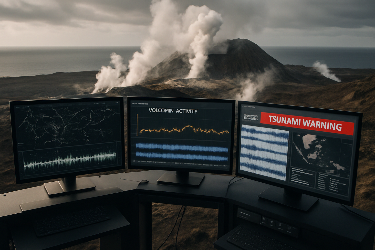
Tonga experienced one of the most dramatic geological events of the 24-hour period when a magnitude 7.6 deep earthquake struck near the archipelago, triggering urgent tsunami warnings across the Pacific nation. The Tonga Meteorological Service issued an "Urgent Tsunami Warning" for all islands, with the National Tsunami Warning Centre confirming that dangerous tsunami waves could occur within minutes of the seismic event.
The powerful earthquake was felt across Tonga's entire territory, prompting immediate evacuation procedures as residents moved to higher ground in accordance with established emergency protocols. Coastal communities, particularly vulnerable due to Tonga's low-lying geography and scattered island configuration, implemented well-rehearsed evacuation plans developed in the aftermath of the devastating January 2022 Hunga Tonga-Hunga Ha'apai volcanic tsunami.
Fortunately, ocean conditions stabilized more rapidly than initially feared. Tonga's National Disaster Risk Management Office confirmed that tsunami warnings were cancelled for the entire country after comprehensive monitoring showed no dangerous wave activity materializing. The final alert was lifted in the Vava'u island group, allowing evacuated residents to return safely to coastal areas.
"Ocean conditions have stabilised across all island groups, including Vava'u, where the final remaining alert was lifted."
— Tonga's National Disaster Risk Management Office
New Zealand's Risk Assessment
New Zealand's emergency management authorities conducted thorough tsunami threat assessments following the Tonga earthquake, ultimately determining that no tsunami danger existed for New Zealand's coastlines. This conclusion, while reassuring for New Zealand residents, highlighted the sophisticated monitoring systems now in place across the Pacific to track seismic events and their potential oceanic consequences.
The rapid assessment and communication of tsunami risk represents a significant advancement in Pacific disaster preparedness since the 2011 Japan tsunami, which exposed critical gaps in regional warning systems. New Zealand's ability to quickly evaluate and communicate tsunami risk reflects investments in advanced seismological monitoring and international cooperation frameworks developed over the past decade.
Global Context of Geological Instability
The simultaneous occurrence of seismic and volcanic events across Iceland, New Zealand, and Tonga within a 24-hour window reflects broader patterns of geological instability that have characterized 2026. These events occur against the backdrop of 21 consecutive months of global temperatures exceeding 1.5°C above pre-industrial levels, raising questions about potential correlations between climate change and geological activity.
While direct causal links between climate change and seismic activity remain scientifically controversial, some researchers suggest that changing ice masses, ocean loading, and altered precipitation patterns may influence geological stress patterns over geological timescales. The Arctic region, including Iceland's position on the Mid-Atlantic Ridge, may be particularly susceptible to such influences as polar ice continues its accelerated retreat.
Historical geological records demonstrate that periods of significant climate transition have often coincided with increased volcanic and seismic activity, though establishing definitive causation remains challenging. The current pattern of elevated geological activity across multiple tectonic boundaries warrants continued scientific investigation and enhanced monitoring capabilities.
International Cooperation and Monitoring
The rapid response and coordination demonstrated during the March 24 geological events highlight the effectiveness of international cooperation frameworks developed over the past decade. Pacific tsunami warning systems, enhanced following the 2004 Indian Ocean tsunami and refined after subsequent Pacific events, proved their value in providing timely and accurate threat assessments.
Iceland's sophisticated seismic monitoring network, developed through decades of volcanic surveillance experience, continues to provide crucial data for understanding North Atlantic geological processes. The country's expertise in volcanic monitoring has become increasingly valuable for international geological cooperation, particularly as other regions face growing volcanic threats.
New Zealand's integration of volcanic monitoring with tourism safety protocols represents a model for other volcanically active regions seeking to balance economic activity with public safety. The lessons learned from White Island's 2019 tragedy have informed improved monitoring protocols and emergency response procedures that benefit geological risk management globally.
Climate and Geological Intersection
The concentration of geological events during a period of unprecedented climate instability raises important questions about the interconnected nature of Earth's systems. While the immediate triggers for seismic and volcanic activity remain primarily geological, the broader context of rapidly changing environmental conditions may influence the timing and intensity of geological events.
Arctic regions, including Iceland's unique position straddling the Mid-Atlantic Ridge, face particular challenges as changing ice loads and ocean temperatures potentially alter geological stress patterns accumulated over millennia. The Reykjanes Peninsula, site of recent volcanic activity and Monday's earthquake swarm, sits at the intersection of multiple geological and climate influences that make it a critical location for understanding these potential interactions.
Pacific island nations like Tonga, positioned on some of the world's most active geological boundaries, face the compound challenges of geological instability and climate change impacts including sea level rise and intensifying storm systems. The successful management of Monday's tsunami alert demonstrates regional preparedness capabilities, but also highlights the ongoing vulnerability of Pacific communities to multiple environmental threats.
Future Implications and Preparedness
The geological events of March 24, 2026, serve as a reminder of Earth's dynamic nature and the importance of maintaining robust monitoring and response systems across regions prone to seismic and volcanic activity. The successful coordination between national geological services, international monitoring networks, and emergency management agencies represents a significant achievement in global disaster preparedness.
Continued investment in geological monitoring technology, international cooperation frameworks, and community preparedness programs remains essential as evidence suggests potential increases in geological activity coinciding with rapid environmental change. The integration of traditional geological knowledge with advanced monitoring technology, demonstrated particularly effectively in Pacific island communities, provides valuable models for global application.
The rapid sequence of events across Iceland, New Zealand, and Tonga within 24 hours underscores the interconnected nature of global geological systems and the importance of maintaining vigilance across multiple regions simultaneously. As Earth's environmental systems continue evolving under unprecedented human influence, the geological monitoring and response capabilities demonstrated on March 24 will prove increasingly valuable for global safety and scientific understanding.